


![[Add-on] Jackery Manual Transfer Switch for Explorer 5000 Plus](http://ca.jackery.com/cdn/shop/files/add-on-jackery-manual-transfer-switch-for-5000-plus-240V.webp?v=1757043692&width=170)


Wildfire season in Alberta can bring real anxiety, with concerns for the safety of homes, families, and entire communities. Reliable, up-to-date information can be hard to find and even harder to understand.
This guide offers a clear, actionable plan for using the Alberta wildfire map and preparing for any emergency. By staying informed and planning ahead, you can reduce stress and protect what matters most during wildfire season.
Decoding the Alberta Wildfire Map: Status, Symbols, and Key Data
Understanding the official wildfire classifications used by Alberta authorities is the first step to accurately assessing risk. These terms have specific meanings that dictate the level of danger and the appropriate response.
What Are the Official Wildfire Classifications?
- Out of Control: The wildfire is not responding to suppression efforts, showing significant growth, and potentially crown fire. This status implies active and aggressive fire behavior.
- Being Held: The wildfire is not expected to grow past predetermined boundaries under current. Suppression efforts are effective, but the fire is not yet fully contained.
- Under Control: The wildfire is completely surrounded and no longer growing. Suppression efforts are successful, and the fire is expected to be extinguished.
- Extinguished: The wildfire is completely out.
These definitions are sourced directly from the Government of Alberta to ensure you are working with the most credible information.
What Are Wildfires of Note and Mutual Aid Fires?
- Wildfires of Note: These are significant wildfires that are highly visible or pose a potential threat to communities or infrastructure. Examples include the Red Earth East complex or Sousa Creek wildfire.
- Mutual Aid Wildfires: This classification refers to fires where external resources are assisting in suppression efforts.
Always check the map's timestamp before making decisions. Data can have a reporting lag, so looking for the "last updated" time is crucial for understanding how current the information is. A map that is several hours old may not reflect the fire's most recent movement.
Mastering the Map: Key Features and Official Information Sources
Relying on a single source of information can be risky due to potential delays. Layering data from multiple official resources provides the most comprehensive situational awareness during the wildfire season.
What Are the Primary Information Resources?
- Alberta Wildfire Status App: This app offers an interactive map, real-time updates, wildfire locations, size, status, and suspected cause. It is a key tool for immediate information.
- Alberta Emergency Alert App: This app provides critical information on emergencies, including evacuation orders and alerts. It is essential for receiving immediate safety instructions.
- Alberta.ca Website: This is the primary source for comprehensive wildfire information, including sections on wildfire status, maps and data, and preparedness. You can also subscribe for email updates.
- Social Media Channels: Official Alberta Wildfire social media accounts provide quick updates. Always verify information from these official sources.
What Are the Forest Protection Area and Fire Danger Ratings?
- Forest Protection Area (FPA): These are designated areas in Alberta where the provincial government is responsible for wildfire management. The FPA is divided into 10 forest areas, and updates specific to each area are available.
- Fire Danger Rating: This rating assesses fire risk (low, moderate, high, very high, extreme) based on weather and fuel conditions. It helps residents understand the risk and adhere to fire bans or restrictions.
- Fire Bans and Restrictions: Information on different types of bans, such as fire bans and off-highway vehicle restrictions, is available on the Alberta.ca website.
What Are Some Actionable Tips for Using the Map?
- Cross-reference sources: Compare information from the Wildfire Status Dashboard, Alberta Emergency Alert, and local municipal sources to get a complete picture. This helps compensate for any single source's reporting lag.
- Cache data for offline use: If you plan to travel into an area with poor or no cell service, download or take screenshots of the map beforehand.
- Share official links: To prevent the spread of misinformation, always share direct links to official maps and alerts, not unverified screenshots from social media.
Your Action Plan: Evacuation Alerts and Preparedness Checklist
When a wildfire threatens a community, authorities issue structured evacuation stages. Understanding what each stage means is critical to a safe and orderly response.
What Are the Official Evacuation Stages?
- Evacuation Alert: This means there is a potential threat, and you must prepare to leave. Use this time to gather essentials, plan routes, and monitor official channels.
- Evacuation Order: This means there is an immediate threat, and you must leave for safety. Obey immediately, follow designated routes, and inform authorities of your departure.
What Should Be in a 72-Hour Go-Bag?
Your go-bag should contain everything your family needs to be self-sufficient for at least 72 hours.
- Essentials: Water (4 litres per person per day), non-perishable food, prescription medications, and a complete first-aid kit.
- Documents & Power: Copies of important documents (ID, insurance policies), phone chargers, and a portable power bank.
- Safety & Comfort: N95 masks to protect from smoke, supplies for pets, and a battery-powered or hand-crank radio.
What Are the Critical Household Readiness Steps?
- Fuel Up: Always keep your vehicle’s gas tank at least half-full during high-risk periods.
- Know Your Utilities: Learn how to shut off your home's gas, water, and electricity. Only do so if instructed by officials.
- Create Defensible Space: Reduce the risk to your home by clearing flammable debris like pine needles, dry leaves, and firewood from at least 10 meters around your house.
- Establish a Communication Plan: Designate an out-of-area contact person that all family members can check in with. Also, choose a safe meeting point for your family in case you get separated.
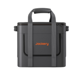
Powering Through Wildfire Emergencies: Portable Power Solutions
Wildfires often cause power outages, making it harder to stay safe and informed. Without power, communication devices go down, food and medicine can spoil, and essential medical equipment may stop working.
A portable power station provides a safe, silent, and fume-free way to keep your critical electronics running so you can stay connected and protected when it matters most.
What Are the Benefits of Portable Power Stations?
- Reliability: Provides backup power when the grid is down.
- Versatility: Can power phones, radios, lights, small appliances, and medical devices.
- Safety: Cleaner and quieter than traditional generators, with no fumes, allowing safe indoor use.
Which Power Solutions Are Recommended?
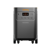
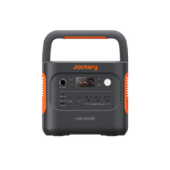
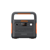
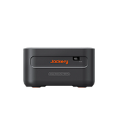
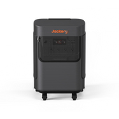
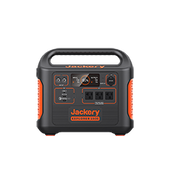
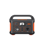
Jackery Solar Generator HomePower 3000
- High capacity (3072Wh) for extended outages.
- Multiple output ports for various devices.
- Recharges in as fast as 1.7 hours.
- Robust design for outdoor use.
This unit is ideal for home backup during extended outages, ensuring critical appliances like a full-size refrigerator (400W for 6 hours) remain operational.

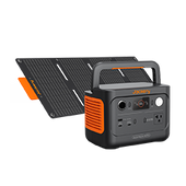
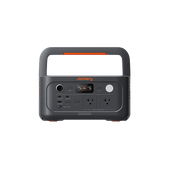
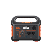
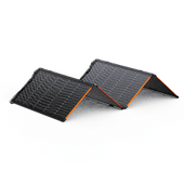
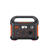
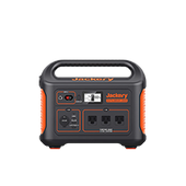
Jackery Solar Generator 1000 v2
- Moderate capacity (1070Wh) for shorter outages.
- Lighter weight for increased portability.
- Emergency supercharging (0-100% in 1 hour).
- Excellent for charging phones, laptops, and lights.
This generator offers a powerful balance of capacity and portability for evacuation scenarios, running a WiFi router (10W) for 35 hours.

How Do I Choose the Right Solution?
To choose the right power station, you need to estimate your energy requirements. Consider your power needs (wattage), the duration of potential outages, your budget, and portability requirements.
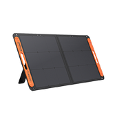
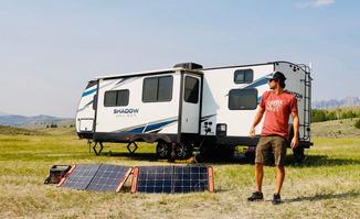
The ability to recharge with Jackery solar panels is a key advantage during prolonged, multi-day outages, creating a self-sustaining power solution when the grid is down. For more information on preparing for outages, see our guide on the power outage map and backup solution in Canada.
Stay Informed, Prepared, and Safe
True wildfire safety rests on three pillars: understanding the alberta wildfire map, having a clear action plan, and ensuring you have reliable backup power. Proactive preparation is your greatest asset. By bookmarking official sources, packing your go-bag, and securing a power solution like a Jackery Solar Generator, you can face the wildfire season with confidence. Test your emergency plan and power sources before an alert is issued. This ensures you and your family are ready to act decisively when it matters most.
Frequently Asked Questions
How can I ensure my pets are safe and accounted for during an evacuation, especially if I have multiple animals or livestock?
Create a pet-specific emergency kit with food, water, and medication. Pre-identify pet-friendly shelters or hotels and plan large animal evacuation routes and destinations ahead of time.
Beyond the official map, are there any community-led or local alert systems that can provide more granular, real-time updates for my specific neighborhood?
Check your local municipality's website for a regional emergency alert system. Community Facebook groups or neighborhood watch programs can also provide hyper-local, real-time information during a crisis.
What are the long-term health impacts of prolonged smoke exposure, and what steps can I take to protect my indoor air quality during wildfire season?
Prolonged smoke exposure can cause respiratory issues and other health problems. Use a high-efficiency air purifier, keep windows and doors sealed, and designate one room as a "clean air room."
If an evacuation order is issued while I'm away from home, what immediate steps should I take to ensure my property is secured and my family knows my whereabouts?
Immediately activate your family communication plan to inform everyone of your location and status. If possible, contact a trusted neighbor to check on your property and provide updates.
Are there any financial assistance programs or insurance considerations I should be aware of if my property is damaged or I incur significant costs due to a wildfire evacuation?
Review your home insurance policy for wildfire and evacuation cost coverage. Research provincial and federal disaster relief programs that may become available to assist affected residents.


